Posted by dean on September - 25 - 2012
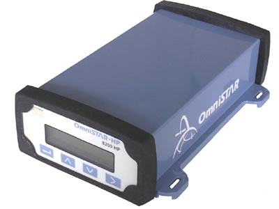
The OmniSTAR 8200HP Receiver is a sturdy, low maintenance, cost efficient L-band capable receiver. The receiver incorporates many features for flexible operation. The standard 10 Hz position output enables accurate positioning, even under high dynamic or high-speed circumstances. Its rugged, waterproof enclosure protects the receiver against accidental drops and keeps [ Read More ]
Posted by dean on September - 25 - 2012
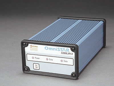
The 32000LR12 Series DGPS receivers are the product of years of research and development and represent the latest technology and one of the highest levels of integration yet be seen in Satellite DGPS receivers. The 3200LR12 is a full function receiver system inside a small format field case with LED [ Read More ]
Posted by dean on September - 24 - 2012

Hydrographic Survey Software Trimble HYDROpro Navigation software is an easy to use software solution for today’s hydrographic surveyor. Designed with superior performance and efficiency in mind it allows for significant improvements in productivity on even the most complex marine survey application. The HYDROpro Navigation software uses advanced time-stamping techniques for [ Read More ]
Posted by dean on September - 24 - 2012
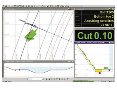
Marine Survey and Construction Software Trimble HYDROpro Construction software is a comprehensive software package for marine and waterway construction tasks that require precise positioning. With the HYDROpro Construction software, projects can be completed faster, safer, and more economically than with conventional methods. The software builds on the patented and proven [ Read More ]
Posted by dean on September - 24 - 2012
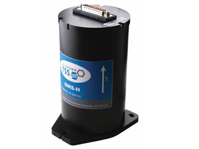
Whether in ports and harbours, offshore or as part of a hydrographic mapping programme, the need to measure ocean depths with the utmost accuracy is vital. The DMS-H heave sensor has been developed to work with a wide range of modern single beam echo-sounders. With their design allowing acceptance of [ Read More ]
Posted by dean on September - 24 - 2012
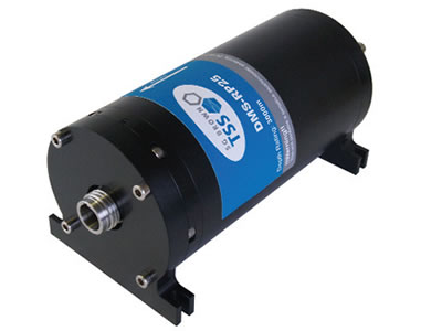
The DMS range of motion sensors has been designed specifically for the motion measurement needs of the marine industry. Whether it is achieving IHO standard survey from any size of vessel, or providing safety critical monitoring of offshore platforms, large vessels, helicopter landing decks, cranes and positioning systems, the DMS [ Read More ]
Posted by dean on September - 24 - 2012
High Definition .. Versatile .. Easy to Use .. Robust Rugged CM2 Sonar Transceiver (STR) and PC running MaxView acquisition software. The STR’s USB interface needs no extra hardware. Simple optional connection to third party software. View the brochures for full specification (CMAX Side Scan Sonar)
Posted by dean on September - 24 - 2012

Delivers accurate 2D GPS heading data (heading and roll or pitch) with better than 0.1 degree rms accuracy with a short 2 m antenna separation Computes accurate heading at rates of up to 10 Hz and position at rates of up to 5 Hz Includes internal SBAS demodulator for differential [ Read More ]
Posted by dean on September - 24 - 2012

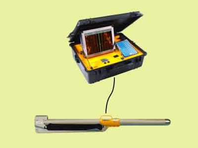
High Resolution, Dual Frequency Hydrographic Echo Sounder The Bathy-1500 is the new standard in dual frequency hydrographic survey echo sounders. This economical hydrographic survey instrument is a complete integrated echo sounding system. The Bathy-1500 relies upon advanced, microprocessor-based electronics and features a backlit, grey scale graphical LCD chart display. View [ Read More ]
Posted by dean on September - 24 - 2012
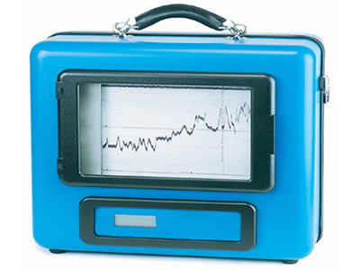
Underwater Topography Recording from Compact Survey Instrucment The Bathy-500MF is a state-of-the-art electronic survey instrument used to generate precision chart recordings and digital data output. Low power consumption, portability, ease to use, rugged construction,and built-in communication interfaces for navigation/data logging make the Bathy-500MF ideal for shipboard use. View the brochures [ Read More ]